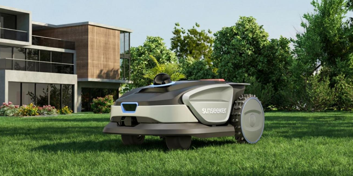
AI-powered robotic mowers no longer wander around the yard and hope for the best. They build detailed digital maps and then follow smart paths with centimeter-level accuracy. This shift comes from powerful hardware and software: RTK GPS, 3D LiDAR, cameras, and advanced mapping algorithms. A leading example is the Sunseeker S4, which uses its AllSense™ 3D Fusion Sensing System and AI-based Truepilot™ 3D Auto-mapping to scan and model your garden in rich 3D. It can complete a full map of many lawns in around 15 minutes and then mow each zone efficiently. Understanding how these systems work helps you choose a mower that cuts cleanly, avoids obstacles, and saves time.

What Technologies Do AI Mowers Use to Map Your Lawn?
RTK GPS and High-Precision Positioning Systems
RTK GPS gives AI mowers a precise sense of location, far beyond what standard GPS offers. While normal GPS can drift by several meters, RTK (Real-Time Kinematic) GPS uses correction data from a base station to reach centimeter-level accuracy. The mower compares satellite signals with the base station’s known position. It then corrects errors in real time. This high-precision positioning lets the mower follow clean, parallel lines instead of random patterns. It also helps the mower know exactly where boundaries, flowerbeds, and paths sit on the digital map. Some models blend RTK GPS with local reference points and inertial sensors for better reliability near trees, buildings, or fences. The result is consistent mowing patterns, fewer missed strips, and less overlap, which saves battery life and reduces mowing time.
Sensors, Cameras, and Vision-Based Mapping Technology
Beyond GPS, AI mowers rely heavily on sensors and cameras to “see” your lawn. Advanced systems like the Sunseeker S4 use high-precision 3D LiDAR that generates over 210,000 point clouds per second. The LiDAR sends out laser pulses, measures how long they take to return, and builds a dense 3D picture of your garden. Vision AI then analyzes this data along with input from cameras and bumper sensors. The mower detects edges, slopes, trees, toys, and garden furniture. The S4, for instance, provides a 360° and 70° vertical scanning range, helping it identify and avoid more than 360 types of obstacles. By combining this rich perception with accurate positioning, vision-based mapping technology supports safe navigation, precise cutting near borders, and detailed digital lawn models that improve over time.
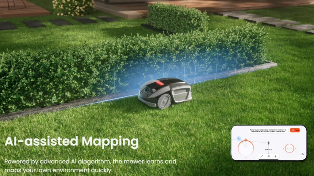
SLAM and Real-Time Mapping Algorithms Explained
SLAM stands for Simultaneous Localization and Mapping. It is a core algorithmic approach that lets AI mowers build a map while figuring out their position within that map. As the mower moves, SLAM takes readings from LiDAR, cameras, wheel encoders, and inertial sensors. It matches these readings with previous observations to estimate movement and update the map. Modern AI mowers use variants such as visual SLAM and LiDAR-based SLAM. Visual SLAM focuses on features detected by cameras, while LiDAR-based SLAM uses point clouds. The Sunseeker S4’s Truepilot™ 3D Auto-mapping combines 3D LiDAR data and AI to generate a detailed 3D layout of your yard in about 15 minutes. With SLAM, the mower reacts to changes in real time, tracks its exact route, remembers obstacles, and refines the map during every mowing session.
How Do AI Mowers Build and Optimize Lawn Maps?
Sensor Fusion: Combining GPS, IMU, and Vision Data
Sensor fusion is the process that ties everything together. The mower’s control system collects data from RTK GPS, an IMU (Inertial Measurement Unit), LiDAR, cameras, and bumper sensors. Each sensor has strengths and weaknesses. GPS gives global position but can struggle under trees. The IMU tracks motion but drifts over time. Cameras and LiDAR see detail but can be affected by lighting or reflective surfaces. Through fusion algorithms, the mower weighs each signal and creates a single, reliable estimate of its position and surroundings. The Sunseeker S4’s AllSense™ 3D Fusion Sensing System is a clear example: it merges 3D high-precision LiDAR with AI-assisted visual sensing and other inputs to reach centimeter-level positioning. This comprehensive understanding allows the mower to build accurate 3D maps, follow tight edges, and react smoothly to unexpected objects in the yard.
Path Planning Algorithms and Coverage Optimization
Once the mower has a solid map, it needs to decide how to move. Path planning algorithms handle this. They divide your lawn into zones, plan coverage paths, and avoid obstacles while minimizing time and energy use. Instead of random motion, AI mowers calculate systematic patterns: parallel stripes, contours around beds, or optimized back-and-forth routes. Coverage optimization algorithms look at the map’s shape, slope, and restricted areas. They choose paths that reduce overlap and avoid missing narrow strips or corners. The mower’s software adjusts speed and direction near tight spaces, borders, and slopes. Products like the Sunseeker S4 can even perform individual zone mapping, so the mower treats each section of your garden differently for better results. The outcome is a balanced cut, clean edges, and efficient battery use with fewer passes.

Machine Learning and Adaptive Mapping Improvements
Machine learning helps AI mowers get smarter the more they mow. The system records where it slows down, senses obstacles, or struggles with traction. It then uses these data points to adjust future routes and cut heights. If the mower regularly detects toys or furniture in a certain area, it can treat that space with extra caution.
Models also learn visual patterns associated with grass, stones, flowerbeds, and garden structures. The Sunseeker S4, with its AI-powered Truepilot™ 3D Auto-mapping, refines the 3D map as conditions change over weeks and seasons. Over time, the mower improves edge handling, obstacle avoidance, and coverage quality. This adaptive mapping means fewer manual interventions, fewer bumps, and a consistently better-looking lawn without extra effort.
Conclusion
AI-powered mowers map your lawn precisely by combining high-precision positioning, rich 3D sensing, and advanced algorithms. RTK GPS and inertial units establish accurate location, while sensors such as 3D LiDAR, cameras, and bumpers give a detailed view of terrain and obstacles. SLAM and sensor fusion turn these streams of data into a stable, evolving 3D map. Systems like the Sunseeker S4’s AllSense™ 3D Fusion Sensing and Truepilot™ 3D Auto-mapping show how fast and accurate modern mapping has become, delivering efficient coverage and reliable obstacle avoidance. With path planning and machine learning, the mower adapts to your garden’s layout and habits over time. The result is professional-looking stripes, safer operation, and a smarter, more efficient way to keep your lawn perfectly trimmed.